【Guide to the Outlying Islands in the Northeastern Corner of Taiwan】
【Guide to Tamlan Ancient Road North Road in the northeastern corner of Taiwan】
The northeast corner is the place in Taiwan, besides Huadong, where mountains and seas connect!
To go deep into the Northeast corner and appreciate its beauty and play through it, you have to go through the Northeast corner trail!
The highlight of the Northeast Trail is Cola Mountain and Lehai!
And fight against mountains and seas at the same time!
Can be divided into half-day short trails,
It may take more than half a day to connect multiple trails.
Half a day is small and beautiful, just a quick taste,
Half a day or more is considered enjoyable and enjoyable!
I will share the trails in the northeast corner first, excluding Jiufen Old Street.
Because
Shu Yun: “The longer I walk, the less able I am to separate my body, mind and surrounding environment. The external and internal worlds overlap with each other. I am no longer an observer looking at nature, but a whole person Everyone is involved.”
【Short Trail Guide in the Northeast Corner】【Half Day】
1. Northeast corner Jinguashi Shishishan and Jinguashi Qitang Old Street
2. Northeast Point Bitoujiao Trail
3. Northeast corner Nanziqing Trail
4. Northeast Point Longdong Bay Trail
[Outlying Island in the Northeast Corner] [One Day]
1. Northeast corner of Keelung Island
2. Guishan Island in the northeast corner
[Guide to the long trail in the northeast corner] [More than half a day]
1. Northeast Corner Caoling Ancient Trail
2. Northeast corner Taoyuan Valley Trail
[Guidelines for long trails in the northeast corner and connecting multiple trails]
[More than half a day and multiple days required]
1. The connection of Jinzipi Ancient Road, Shumeikeng, Canguangliao and Diaoshan Ancient Road
2. Encountering Ma Kai on the Tamlan Ancient Road, Ma Kai’s missionary journey
3. Hiking at Northeast Point Railway Station
The long trail in the northeast corner is currently mainly located on Tamlan Ancient Road North Road.
The main reason is that the road signs are clear and the transportation is convenient,
Once you enter the paradise of the long trail in the northeast corner,
You will fall in love with the paradise-like scenery here,
But you must live in Taiwan,
Stay here in the northeast corner for a while!
[Outlying Island in the Northeast Corner] [One Day]
[Northeast corner of Keelung Island]
The sea water in the northeast corner is blue in summer, and Keelung Island can be seen from Shuangxi Buyiting Pavilion, Shumei Parking Lot, the old street on Jiufen Mountain, the northeast corner of Shen’ao and Shuinan Cave…and Keelung Island can be seen from the seaside in the northeast corner. It is a kind of nostalgia, whether it is Jinshan, Yeliu or Waimu Mountain; you can see it from exit 62 of Ruibin Expressway!
Go to Taiwan’s Longzhu Island and climb to the top. The side looks like a whale and the bird’s eye view looks like a shark. From the boat, you can look back at the mainland of Taiwan and see Keelung Port, Xiehe Electric Field, Bisha Fishing Port, Shen’ao Fishing Port, Shuinan Fishing Port, Nanya Rock… North You can see Jinshan Jumping Stone Coast, Jinshan Candlestick, Huangzui Mountain and Fagu Mountain in Yangmingshan National Park. You can see Bitou Cape in the south. When you climb to the top of the lighthouse, you can see the Pacific Ocean in the east and the northeastern corner of Taiwan’s mainland in the west. The mountains are so beautiful!
On that day, we saw the Keelung Sea Threshold, where the current flowed through the ridgeline of the seabed, creating white swells.
The sill is a narrow ridge formed by rock formations on the sea floor, like a threshold falling on the seabed. Affected by the sea sill, the sea water near Keelung Island is relatively shallow. Large ships will avoid it when sailing and pass through the deep water area near Heping Island to avoid running aground on the rocks. Keelung and the surrounding sea are mostly rough. It is the high and low tide currents that pass through the sea sill to form a special walrus. This can only be clearly seen by waiting for an overhead or aerial camera.
Think about it, although Taiwan does not have vast expanse of grassland, but it does have boundless blue Pacific Ocean to be proud of!
Record the golden sunset on the return ship!
Keelung Island, also known as Keelung Island, is an island located in the East China Sea in the northeast of Taiwan. It was called Jilong Island and Jilongji in ancient times. It is about 3.3 kilometers away from Heping Island in a straight line and about 4 kilometers away from Keelung Port. The administrative district belongs to Keelung. Zhongzheng District of the city. Because it is isolated on the sea, it has become an obvious natural landmark in Keelung and the northeastern corner. Now it is also open for sightseeing on the island…Wikipedia
It has not been open for more than five years due to damage to the pier. It is currently possible to visit the island, which is very suitable for family travel, but the season is limited, so seize the opportunity!
In the eyes of experts, it is the best volcanic geopark in northern Taiwan. The rich andesite and tabular joint terrain on the island has become the largest landscape feature on Keelung Island. The northeast of the island is a cliff, forming a sea cave. And the rocky terrain; the sea area of Keelung Island is a famous fishing ground. There are more than 30 kinds of fish that can be found here. There is a Guanyin Buddha statue and Tuigong on the relatively flat part of the island.
May and June are the lily season, and August to September is the Lycoris season. If you choose this time to land on the island, you will be filled with happiness.
Thanks to the good weather and not too hot, the last boat trip of the day had the opportunity to go to Taiwan’s Longzhu Island and climb to the top. The side looks like a whale and the bird’s eye view looks like a shark. The boat looks back at Taiwan’s land, and you can see Jinshan Jumping Rock Coast to the north, and the coast to the south. Looking out over the corner of Bitou, I only have one thought in my mind: how beautiful the rolling hills in the northeast corner are!
Think about it, although Taiwan doesn’t have vast expanse of grassland, it does have vast expanse of blue Pacific Ocean!
If you have the chance, go to Keelung Island for a trip,
It’s like climbing Yangmingshan in Taipei and New Taipei and climbing the Seven Stars Main Peak, it’s iconic and unforgettable!
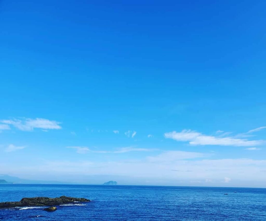
Keelung Island, an outlying island in the northeast corner, is very beautiful when the weather is good and the view from mainland Taiwan to Keelung Island is breathtaking
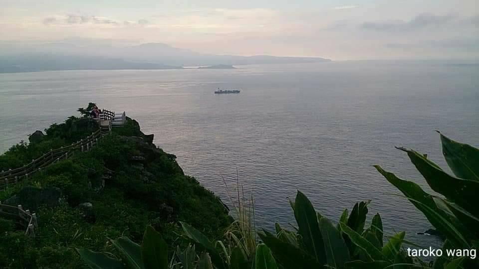
The outlying island Keelung Island in the northeast corner overlooks the mountains and seas of Taiwan’s landmass, which is extremely beautiful
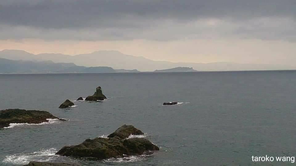
The outlying island Keelung Island in the northeast corner overlooks the mountains and seas of Taiwan’s landmass, which is extremely beautiful
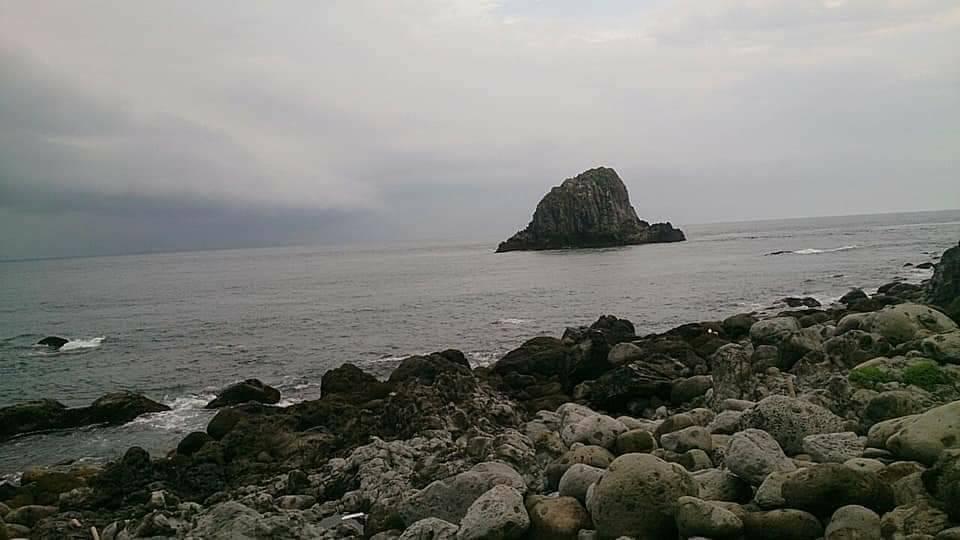
The coast of Keelung Island, an outlying island in the northeast corner
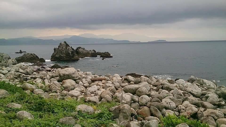
The coast of Keelung Island, an outlying island in the northeast corner
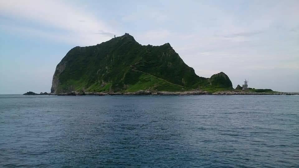
The beautiful panoramic view of Dragon Pearl on the Sea, an outlying island in the northeast corner of Keelung Island
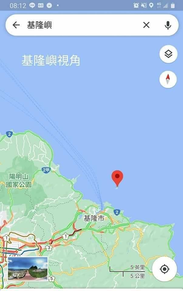
The outlying island Keelung Island in the northeast corner of the sea looks back at Taiwan’s perspective
【Outlying Island in the Northeast Corner】
[Guishan Island in the northeast corner]The northeast corner of Keelung Island and Guishan Island are respectively the Shuijinjiu landmark on the north coast of Keelung and the landmark of Lanyang Plain.
As you pass by the northeast corner, you will be looking towards Keelung Island or Guishan Island!
To go to Keelung Island, depart from Bisha Fishing Port, and to go to Guishan Island, depart from Wushi Port.
Guishan Island has recently been affected by the epidemic, and the impact on Milk Lake Island has been extremely severe.
Wushi Fish Port
Wushi Fishing Port was opened in the sixth year of Daoguang reign of the Qing Dynasty (1826 AD). Due to the prosperity of foreign trade, the Qing Dynasty set up forts, customs and garrisons here. It was once the largest port in Yilan. It was flooded in 1878 and 1883. The decline of the American ship after it ran aground.
In the 1980s of the Republic of China, the port was transformed into a diversified tourist and fishing port.
Guishan Island is the spiritual landmark of Yilan people. It can be seen almost along all the coastline of Taiwan’s second line, from Lailai, New Taipei to Suao, Yilan.
For details, please refer to the previous post
In the past, there were up to 700 residents living on the island. With the passage of time, there are no residents on the island except coast patrol personnel.
The view of the snow-capped mountains and Guishan Island on the Pacific Ocean in the early morning is breathtaking.
When traveling around Guishan Island, the north and south sides have different colors,
Also overlooks the summit of Mount Fuji-like 401 Plateau.
According to the “Taiwan Province General Chronicle”, there is the following record: “It is said that in the first year of Daoguang in the Qing Dynasty (1821 AD), a native of Zhangzhou was born in Kou Village, Dakeng, Touwei (now Dakengli, Toucheng Town). More than ten families moved here.” This is one of them.
According to documentary records, residents settled permanently on Guishan Island in 1853. Although Guishan Island is a private property, it is an uninhabited island. Fishermen often come to the island to rest, and gradually stay and develop into a village. Fishing is the main industry, and peanuts are also grown. The land is leased from the Chen family.
However, due to the difficulty of living and the inconvenience of sea transportation, they gradually moved back to the main island of Taiwan.
In 1977, the government classified Guishan Island into the shooting area of the artillery shooting test range. Villages were forcibly relocated due to military needs. All residents of Guishan Island were relocated to Daxi, Toucheng. Before that, Renze Community was built to resettle The relocated households on Guishan Island.
The Mazu Temple “Gonglan Palace” on the island was also moved back to Daxi. The temple is still there, but the Mazu statue has gone, and the soldiers stationed on the island had to change it to the “Guanyin Temple” to worship Guanyin on Putuo Mountain in the South China Sea. Bodhisattva, as a spiritual sustenance, is called “Putuo Rock on Guishan Island”.
After martial law was lifted in 1988, Guishan Island was reopened in December 1999, officially opened to the public for sightseeing on August 1, 2000, and included in the Northeast Coast National Scenic Area!
The summer trip to Guishan Island 401 Highland is a blast of heat. When the northeast monsoon comes in winter, it reminds me of the unique feeling of summer!
When the weather is fine, the sea surface is like a pool, the body feels hot, and the mood is indeed happy.
The unforgettable sea and sky of Keelung Island and Guishan Island!
【Outlying Island in the Northeast Corner】
[Guishan Island in the northeast corner]The northeast corner of Keelung Island and Guishan Island are respectively the Shuijinjiu landmark on the north coast of Keelung and the landmark of Lanyang Plain.
As you pass by the northeast corner, you will be looking towards Keelung Island or Guishan Island!
Guishan Island is a spiritual landmark for Yilan people. It can be seen almost along all the coastline of Taiwan’s second line, from Lailai, New Taipei to Suao, Yilan.
For details, please refer to the previous post
Guishan Island can be seen from Lanyang Plain, from the Taiqijia Line in Datong District to the mouth of the East River, and there are also walksTaoyuan Valley Trail in the northeast corner, you can also see Guishan Island when the weather is good!
Also known as “Guishan Island”, it is a volcanic island in the sea about ten kilometers east of the coast of Yilan Tau Town. It is named after its shape like a floating turtle. It seems to symbolize that “Turtle and Snake are guarding the mouth of the sea” guarding the Lanyang Plain. From any corner of the plain, you can see it standing on the Pacific Ocean if you look towards the sea. Therefore, some geographical landscapes are listed as the “Eight Scenic Spots of Turtle Mountain”.
It covers an area of about 2.85 square kilometers, is about 3 kilometers long from east to west, and is about 2 kilometers wide from north to south. The coastline is about 9 kilometers long and has rich marine ecological resources and volcanic terrain and landscapes. It is a great natural classroom.
Eight Scenic Spots of Turtle Mountain
There are cliffs, cold springs, submarine hot springs, sea caves, Guwei Lake and Guishou Lake and other lakes, and there are rumors of “Guishan Asahi”, “Guido Sulfur Smoke”, “Guiyan Caipi”, “Turtle Egg” There are 8 wonders: “Watching the wonders”, “The turtle wagging its tail”, “The turtle wearing a hat”, “Stalactite wonders in the Spectacle Cave”, and “Undersea hot springs gushing upstream”. Due to factors such as tides and climate, it is not easy to take in all eight views at the same time.
Not only Hawaii, Guishan Island is also a volcanic island!
According to the report, Kameyama Island is the southwest extension of the Ryukyu Island Arc. Geologists believe through dating methods that Kameyama Island may have been formed through several submarine volcanic eruptions 200,000 to 20,000 years ago. It was found that at least four more volcanic activities occurred in 7000 years ago. It is one of the surviving volcanoes in Taiwan and the youngest volcanic island.
401 Heights
Climbing Highland 401 is a must, but during the Japanese occupation, there were venomous snake research institutes on Guishan Island, Yangmingshan, and Taipingshan Renze, so you need to pay attention.
There are two hiking trails in the 401 Highlands, namely the North Shore Hiking Trail and the 401 Highland Trail. The North Shore Hiking Trail is not open to the public, so travelers who want to climb the 401 Highlands can only take the 401 Highland Trail, which is about 1,400 meters long. There are 1,706 steps. After climbing to the high ground, the view of the sea from the highest point of Guishan Island, which is 398 meters above sea level, is worth the hard work. Especially the moment when you see the turtle’s head and tail after climbing high, and the moment when you look at the Pacific Ocean and the Yilan Snow Mountains.
After climbing to the high ground, we saw that the turtle head faces east and the turtle tail faces west toward Taiwan mainland. Therefore, most of the previous residents lived in the turtle tail area because it was convenient to return to the main island of Taiwan.
Blue sea and blue sky
The Pacific Ocean, Lanyang Plain, and Guishan Island all play together with the blue sea and blue sky!
I was lucky enough to climb up to the 401 Highland, which has not been opened for a long time. Looking back at the Lanyang Plain, I can see the San Diaojiao Lighthouse in the far east like a small white dot!
You can see San Diaojiao to the north, Yilan to the south, and the beautiful Xueshan Mountains behind the mainland of Taiwan;
Surrounded by the 360-degree blue sea, you feel relaxed physically and mentally!
Both Guishan Island and Keelung Island can see the Pacific Ocean and mainland Taiwan, but they cannot see each other.
When the weather is clear, the sea surface is like a pool, and the sea and sky of Guishan Island are reflected in the mind and heart like a fairyland.
Can’t help but think of it again
Look at the northeast corner day and night. The northeast corner is not only a touch of blue!
The blue of the Pacific…Li Huiling
From the Taiwan Strait in the west to the Pacific Ocean in the east
Everything seems clear and clear!
The beauty of the northeast corner is blended with Pacific blue
The layers are so rich that they cannot be described in words
Come to this sea
Feel the beautiful scenery with glass pearls and shimmering waves
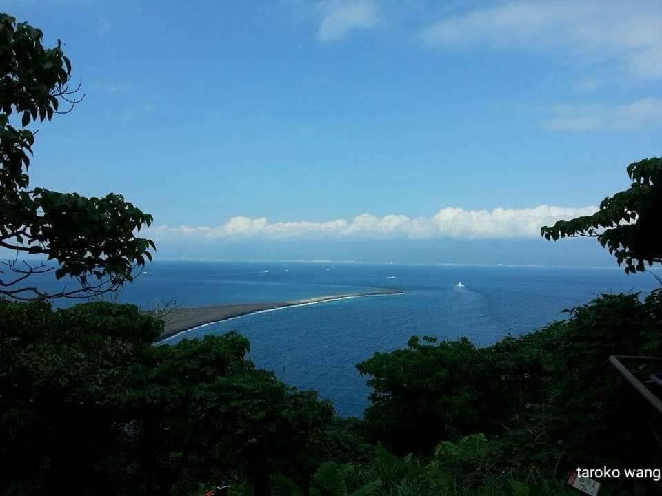
Guiwei, an outlying island in the northeast corner of Guishan Climbing 401, overlooks the Pacific Ocean and mainland Taiwan, all blue in midsummer
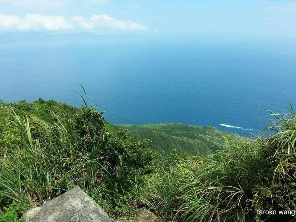
From the northeastern corner of the outlying island Guishan, climb 401 and overlook the Pacific Ocean, which is all blue in midsummer
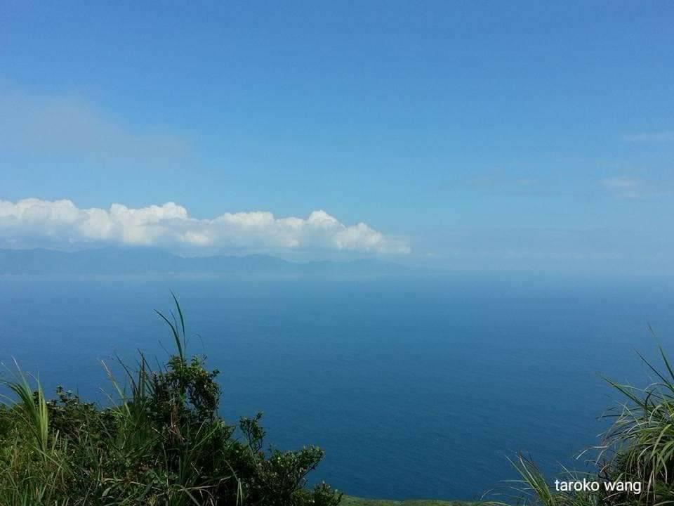
From the northeastern corner of the outlying island Guishan, climb the 401 Highlands and overlook the Pacific Ocean and mainland Taiwan, which are all blue in midsummer
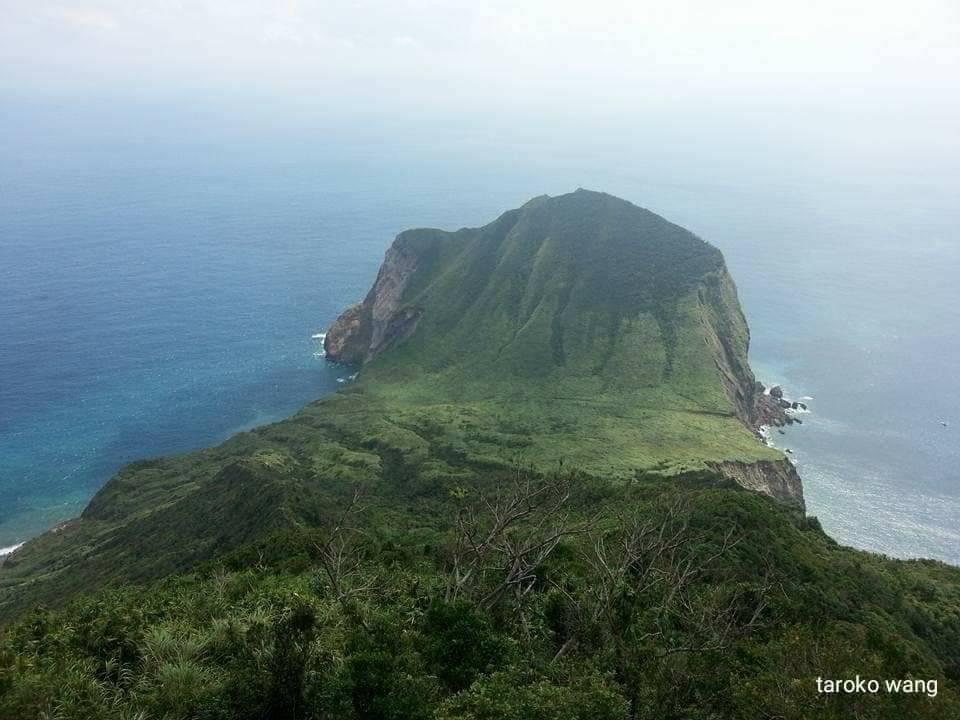
In the northeast corner of the outlying island Guishan Climb 401, the turtle head overlooks the azure Pacific Ocean
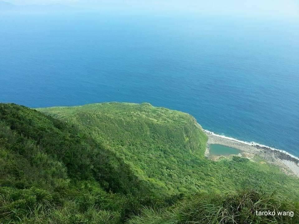
The Pacific Ocean of Guishan Deng 401, Guishan Deng 401, in the northeast corner of the outlying island is blue.
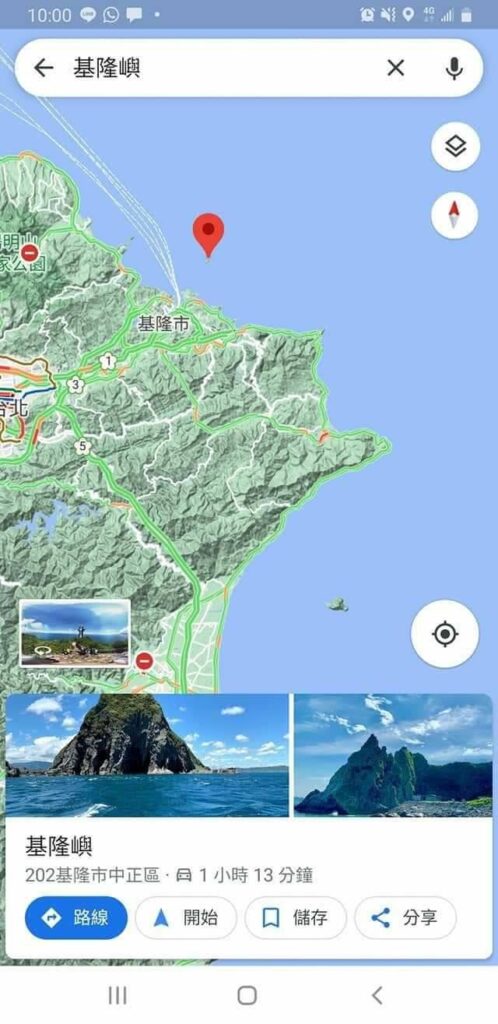
Google location: Guishan Island, an outlying island in the northeast corner of Keelung Island
【Traffic Information】
[Northeast corner of Keelung Island]Google map:
Keelung Island
202 Zhongzheng District, Keelung City
https://maps.app.goo.gl/ZD9DS34rE41oBStK8
The boating location on Keelung Island is Bisha Fishing Port
Google map:
Bisha Fishing Port
https://maps.app.goo.gl/o8MuPoNuboWS6hQq7
Transportation to Bisha Fishing Port in the northeast corner:
Take the High Speed Rail or Taiwan Railway and get off at Taipei Station – transfer to the Taiwan Railway and get off at Keelung Station – transfer to Keelung City Bus 103 or 104 and get off at the Fisheries Direct Sales Center (Bisha Fishing Port) Station.
Take the High Speed Rail or Taiwan Railway and get off at Taipei Station – transfer to the Taiwan Railway and get off at Keelung Station – transfer to Taiwan Travel T99 Binhai Qixi Line and get off at the “Bisha Fishing Port” station.
[Guishan Island in the northeast corner]Google map:
Guishan Island
261 Toucheng Town, Yilan County
Guishan Island boating location is Wushi Port
Google map:
Wushi Fishing Port
https://maps.app.goo.gl/WbKAcAQcM1LZPe3x5
Transportation to Wushi Port in the northeast corner:
Toucheng Railway Station Transfer Passenger Transport
Guoguang Passenger Transport Zhuangwei Dune Line Green 18 (Toucheng Railway Station-Yilan Transfer Station) → Get off at Wushigang Transfer Station
Kamalan Passenger Transport Yilan Jinhao Line 131 (Jiaoxi Railway Station-Northeast Point Scenic Area Waiao Station) → Get off at Wushigang Transfer Station.
【Stop on Saturdays and Sundays】Guoguang Passenger Transport 1766 (Fangfang’ao-Wushi Port Transfer Station) → Get off at Wushi Port Transfer Station.
Guoguang Passenger Transport 1737 (Yinggeshi-Toucheng) → get off at Gangguang Station.
Guoguang Passenger Transport 1740 (Shuangxi Railway Station-Yilan Transfer Station) → Get off at Gangguang Station.
Guoguang Passenger Bus 1811 (Taipei Railway Station-Luodong) or 1812 (Taipei Railway Station-Nangfang’ao) → get off at the port station.
