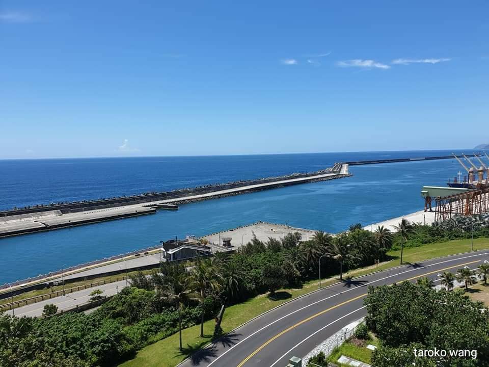
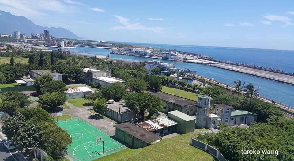
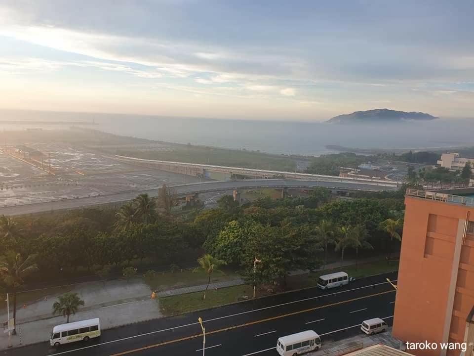
In the early morning, you can also see the mountains and sea in Hualien Port, and the mist in the early morning is like a fairyland
The coastal mountains look like giant whales!
[Huadong Longitudinal Valley Road Today and Past (6)]
[History and Imagery of Hualien Port]
[Hualien Port Pacific Coast Railway and Lingang Line Railway]
If you go to Huadong Coast from the north and follow Suhua Highway to Xincheng, you can choose not to enter the traditional urban area. For example, you can go to Xianfu Road along the Provincial Highway along the Provincial Highway and pass through Meilun to quickly go to Taipei. On the east coast of the 11th line, you can also quickly go to the Rift Valley via Shoufeng, Hualien.
In addition to Meilun Mountain, Hualien Meilun is also close to Hualien Port!
Keelung Port, Suao Port, and Hualien Port all serve as important strategic hubs for Northeast shipping.

[Hualien Port History]
Hualien Port is a homophonic pronunciation of “Huilan Port”. In the 17th year of Jiaqing in the Qing Dynasty (1812 AD), the Han people began to migrate from Yilan. They saw the river running along the bank day and night, and the waves constantly impacting it, creating a lingering state, so they called it “Huilan Port”.
“Huilan Port” is homophonic to “Hualien Port”. It was first seen in the 13th year of Tongzhi in the Qing Dynasty (1874 AD). Shen Baozhen petitioned for the opening of Houshan Road and the establishment of a reclamation committee: “Divide Dongtai into three roads. , Commander-in-Chief Wu Guangliang took charge of it. The south was Beinan, the center was Pushi Pavilion, and the north was Hualien Port. “Papa is the most powerful, and because of its poor sources, Xuanwu’s left and right armies were divided into Dong’ao and Dan’ao. , Dazhuoshui, Deqili, Xincheng, Jialiwan, Hualien Port, Wuquancheng, etc., in case of emergency.”
The name of Hualien Port comes from this, from the commander-in-chief Wu Guangliang.
During the Japanese occupation, the road between Suao Town and Hualien Port was completed in 1931 (today’s Suhua Highway), which made the land connection between Hualien Port and northern Taiwan smooth, but the transportation of goods was still limited. No convenience found.
The Taiwan Governor-General believes that this problem has not been resolved, and the transportation facilities in Eastern Taiwan are still not complete, and there are still great obstacles to local development.
Therefore, within eight years from the same year, construction of the Hualien Port Street commercial port began with a total cost of 7.42 million yen. In 1939, three piers were completed, which can accommodate 3,000-ton cargo ships.
In 1940, the eastern hydroelectric power generation was completed, and it was planned to establish a large number of port industries such as aluminum, electrical, nitrogen, and metal refining. Due to the special need to expand the port, the second phase of port construction was started with 5 million yen. The project was scheduled to be completed in 1944, but due to the Pacific War, the project was suspended. (…Wikipedia)
After the construction of Hualien Port in 1939, it promoted the development of surrounding industries. However, with the advent of World War II, port facilities also became the main target of US military bombing.
After the war, all Hualien Port facilities were destroyed. The restoration was not completed until 1956. The first phase of expansion project began in 1959. The most recent expansion project was the fourth phase, which was completed in 1979. Construction began in 1991 to extend the port to the mouth of Meilun Creek. This is the Hualien Port seen today.
From the past hundred years, we can also see the strategic importance of Hualien Port in history!

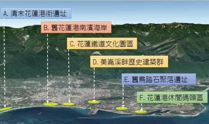
[The history of humanities and landscapes in Hualien Port in the past century]
Hualien Port was only built in 1939!
The boat entry leads to the Hualien beach where the boat arrives.
In 1925, in Nanbin, a small barge was slowly approaching, puffing out thick smoke filled with the smell of kerosene, waiting to receive cargo more than a hundred meters offshore. There is no port in Hualien Port yet.
In the 1920s, when the port had not yet been built, freight transportation to Hualien still mainly relied on shipping to connect with boats off the coast of Nanbin, and to the coastal post from the Nanbin coast to the railway. Hualien Port Street.
Hualien Port Street in 1925, under the Japanese policy planning of using the back mountains of Taiwan as a colonial base, has rapidly carried out various urban constructions. It is a street full of Japanese-style street names, combined with A city with a multicultural atmosphere of Taiwanese aborigines, Han nationalities, and Japanese residents.
In fact, comparing the past and present, Hualien City also has many new residents!
1925 was also the year before the Eastern Line Railway connecting eastern Taiwan from Hualien Port Street to Taitung Street was officially opened to traffic.
The harbor construction project began in 1931, and at the same time, the port-facing railway was built to transport harbor construction materials.
After the port construction was completed in 1939, this route was transformed into the Pacific Ocean Railway for both passenger and freight use until the old Hualien Railway Station was abolished in 1992.
The “Aerial View of Greater Taroko” painted by the Japanese Hatsuru Yoshida in 1935 depicts the image of Hualien Port Street during the construction of the port at that time. From Hualien Old Port to Hualien New Port, There is a series connection between the coastline railway and the port line railway. The opening of these two seaside railway lines has witnessed the development of Hualien Port’s markets. The industrial, cultural and historical development from the urban area to the south and north shores and the construction of the new port of Hualien Port have also been connected in this port line for hundreds of years. .
If we move forward in time, we can follow this Pacific port route to the mouth of Hualien Creek. The outlet of Hualien Creek was the main settlement of Hualien Port Street in the Qing Dynasty. .
The “Peony Society Incident” in 1874 made the Qing Dynasty aware of the importance of governing the “land” in Houshan. In order to prevent foreign forces from coveting Houshan, he embarked on the “opening of mountains and pacification”.
“Hualien Port Street” located at the mouth of Hualien Creek also became an important garrison location for Qing troops. This was a strategic consideration of time and space at that time.
However, as the Japanese colonial government moved Hualien Port Street to the old Xingang Street about three kilometers north, the neighborhood settlements and military barracks at the mouth of Hualien River quickly withered and disappeared into the cultural landscape. The upper part of the scene.
The axis of the Taiping Port Corridor not only witnesses the urban development history of Hualien, but also connects the disappearing historical scenes. The Coast Station located on the Nanbin Coast was abolished in 1941 and was 1.1 kilometers long. The route was still retained, but was demolished in 1982 and used as Nanbin Park land; With the completion of the Hualien New Station and the opening of the North Railway, the Lingang Line to Hualien Port Station was also abolished, and the old train station body was demolished. In 1992, the abandoned line was restructured. It is a bicycle lane, and there are still many people who miss the historical memory of the Lingang Line. They look forward to the resumption of the Lingang Line and recreate the historical scenes and railway transportation legend of the Hualien Lingang Line; The Niaotashi settlement on the northern shore was once famous during the construction of the port. In the 1980s, it was forced to move during the expansion of Hualien Port. The prosperity and scenery of the settlement have disappeared from the map.
[Hualien Port Pacific Ocean Railway]
Although the coastline and port lines of the Hualien Seaside Railway have been abolished and converted into general roads and bicycle lanes, the Hualien Port Pacific Seaside Railway is indeed closely related to the history of Hualien Port.
Sometimes I suddenly have a whim, how good it would be if the Pacific Coast Railway and Victoria Peak Forest Railway were easy to maintain!
Although the coastline and port lines of the Hualien-Linhai Railway have been abolished and converted into general roads and bicycle lanes, it was a rail-road passenger transportation center and commercial core in the early days. It was originally the station area of Hualien Station of the Taiwan Railways. Range, local area and train roundabout.
The Lingang Line railway runs along the Pacific Ocean to the east to the old Hualien Port area, and to the west it reaches the current Hualien Port Station. In the past, the Lingang Line railway departed from the old Hualien Station, carrying students, Americans and It is used by residents of the Hualien area and employees working in Hualien Port to commute to and from work. Although with the opening of the northbound railway and the demolition of the Lingang Line railway, the beautiful scenery of the Pacific Railway is still a common memory for many old Hualien people. Just walk into it like this In the flow of history.
History and humanity are like the condensation of time and space, and the map may be its beautiful manifestation. Open the map to compare ancient and modern times,Combined with the map, the narrative is integrated with the local geographical space, and the past and present are intertwined!
Pacific Lingang Corridor; it is connected with the present and past of Hualien Port, Hualien Port Street, Hualien Creek outlet, Hualien Port Pacific Coast Railway and Lingang Line Railway, and even the current Northern Circle Line, Suhua Past and Present A century of close intertwining!


