The Triangle, Fuguijiao, Bitoujiao and San Diaojiao in northern Taiwan are all capes and have lighthouses.
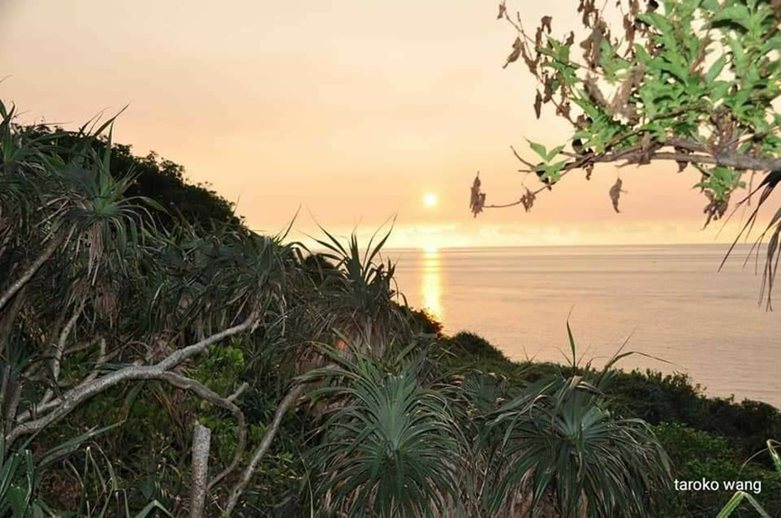
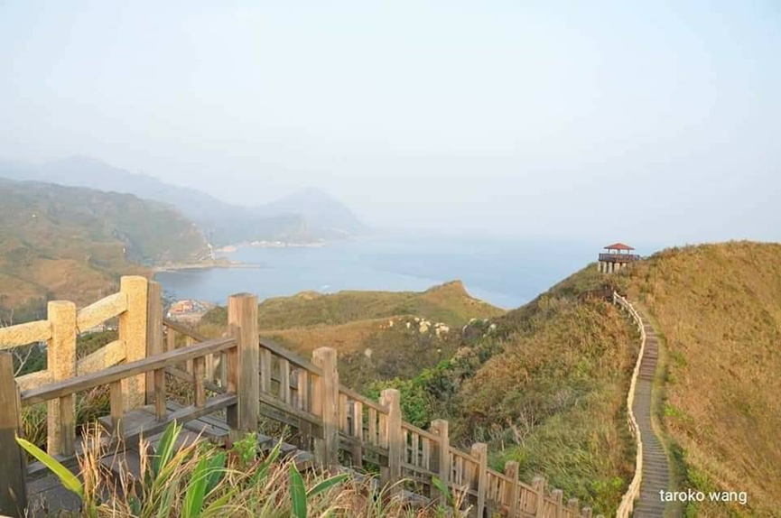
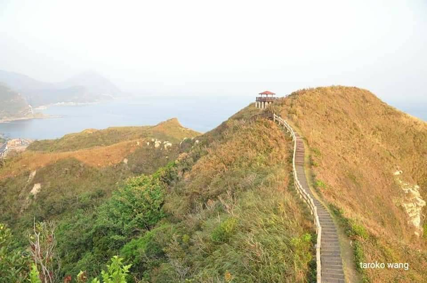
The Bitoujiao Trail is like the Great Wall on the seaside. It is characterized by climbing mountains to look at the sea and sea-eroded platforms.
Walking here feels like you are in a foreign country. The Bitoujiao Trail in the Northeast corner and the Nanzishan Trail are considered to be trails with a high CP value in the Northeast corner. I have been here with foreign friends and they also praised these trails!
If you love the sea more, take a trip to Bitoujiao Trail. If you love mountains more, take a trip to Nanziqing Trail. If you love both mountains and seas, then take a trip to both. You won’t regret it!
Bitoujiao is located in the special scenic area in the northeast corner, and the administrative area belongs to Ruifang Town. The entire area is a promontory with steep terrain, particularly developed sea cliffs, and various erosion structures on sea caves and sea platforms can be seen everywhere. It is located on the windward side of the northeast monsoon, so it is wet, cold and rainy in autumn and winter, and overheated in summer. However, it is still recommended to go in spring and autumn, as it is not too hot and does not rain.
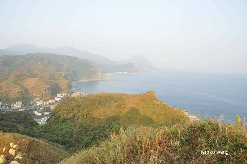
Bitoujiao can be seen from a distance from the second line of Taiwan, whether from north to south or south to north. It can be seen from Fulong, Xianglan, Maao, Guishan Island, and Keelung Island. He can also be seen from the main island.
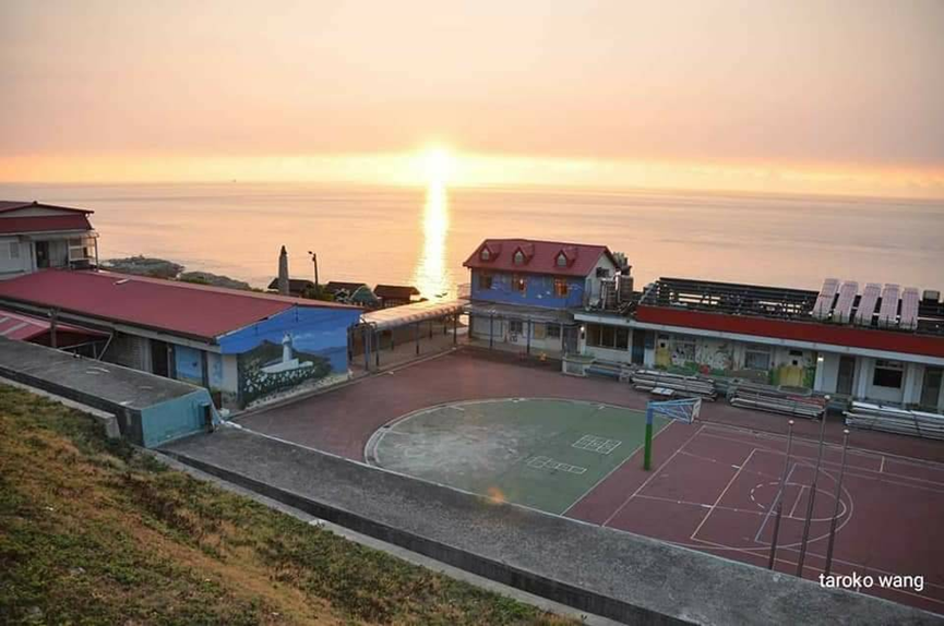
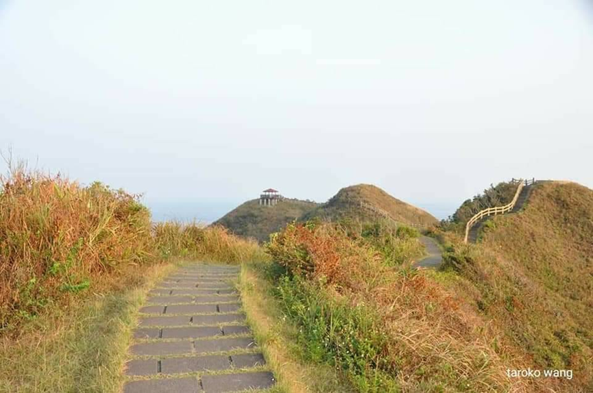
The trail starts from Bitou Elementary School. Follow the trail to Haitian Pavilion. You can see the sea and sky, including Keelung Island, Longdong Bay, and San Diaojiao. Walk along the Linggu Trail to a wide view and look north, where you can see Nanzishan Mountain. and Keelung Mountain. The important landscape characters in the northeast corner seen here appear roughly at the same time.
Whether the weather is cloudy or sunny during this trip, it feels like being in Matsushima, Japan!
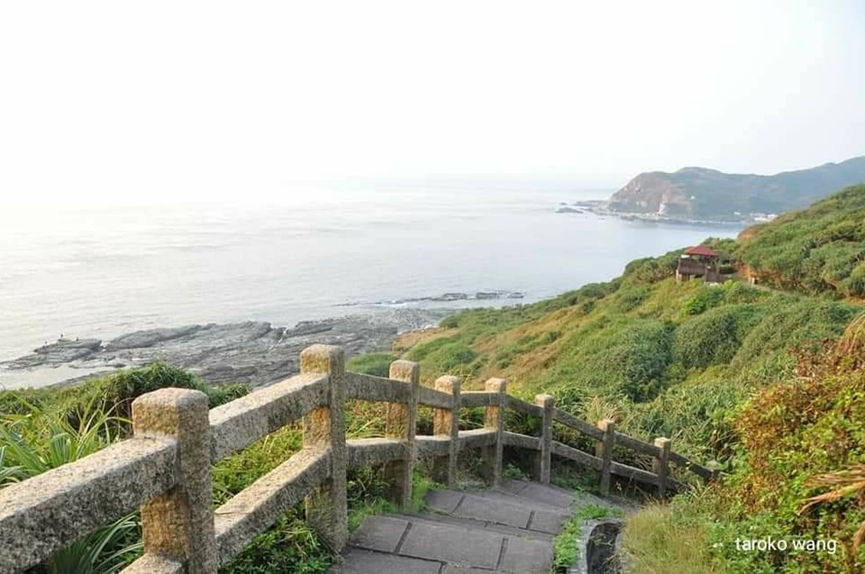
The trail is a circular system, divided into three sections: “Bitoujiao Lighthouse Trail”, “Bitoujiao Ridge Valley Trail” and “Bitoujiao Seaside Trail”. The “Lighthouse Trail” is the main trail, walking on the mountainside, starting from Bitou Elementary School and ending at the Bitoujiao Lighthouse, the most prominent point on the Bitou Cape; the “Lenggu Trail” climbs over the mountain ridge on the Cape, allowing you to climb up and overlook the northeast coast; The “Seaside Trail” is close to the coast, and you can enjoy the ever-changing sea erosion geological landscape of Bitoujiao. All three sections of the trail have their own characteristics.
Bitoujiao Lighthouse was built during the Japanese colonial period as a hexagonal iron lighthouse. It was destroyed by US bombing during World War II and was rebuilt on the original site in the 60th year of the Republic of China. Currently, Bitoujiao Lighthouse and Lighthouse Trail are not open!
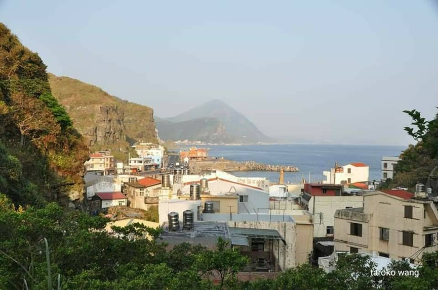
This walk, we walked on the Lenggu Trail and finally walked to the Bitoujiao Fishing Port. In the end, we always returned to the fishing port, but our heart stayed at the Bitoujiao Trail!
You can also share your wonderful experience of walking the Bitoujiao Trail.
Drive there via Taiwan’s Second Line. Parking spaces are limited, so it’s better to arrive early. You can walk from Bitou Elementary School, which is about 2km long and can be completed in one and a half hours.
Suitable for the whole family. There are no meals on the trail, so you need to bring your own. There are meals only when you walk to Bitou Fishing Port.
It’s worth staying one night at Shuijinjiuzhishuinan Cave to experience the Bitoujiao Trail
