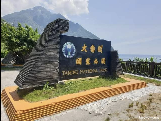
[Trail Guide to Taroko National Park in Hualien, Taiwan]
[Taiwan Taroko National Park Shakadang Trail Small Cone Deer Trail]
[Taiwan Taroko National Park Changchun Temple Trail]
[Yanzikou Trail in Taroko National Park, Taiwan]
[Jiuqudong Trail in Taroko National Park, Taiwan]
[Taiwan Taroko National Park Green Water Confluence Trail]
[Taiwan Taroko National Park Tianxiang]
[White Poplar Trail in Taroko National Park, Taiwan]
Taroko National Park is world-class; people who have walked through it say so;
Before the epidemic, the Taiwanese buses going to national parks were often crowded with foreign tourists!
They are going to Shakadeng, Baiyang, Lushui Wenshan Trails, Zhuilu Ancient Trail, etc…
In this way, the gateways to Taiwan may be Taoji, Taipei 101, the Forbidden City…
But when foreigners who love nature come to Taiwan to travel, their first stop or must-visit is Taroko National Park.
Taroko National Park is also the face of Taiwan!
Vast Canyon Taroko
[Zhongheng and Taroko National Park]
[Say good morning to the refreshing Taroko Mountains]
Detailed links are as follows:
Taroko Terrace in the early morning is mesmerizing!
Standing on the platform in the early morning, I feel a lot inside.
The golden mountain canyon is at the mouth of Liwu River!
Before the epidemic, if foreign friends came to Taiwan for the first time, they would visit 101, Ximending, the Forbidden City…;
If you like nature and are visiting Taiwan for the first time or again, your first choice is Taroko National Park!
Visit Zhongheng, the road bordered by green
Travel through broadleaf forest, mixed coniferous and broadleaf forest, and coniferous forest to arrow bamboo grassland.
Strange rocks, deep valleys and waterfalls, lush forests, shrouded in clouds and mist,
Like a majestic and graceful landscape scroll,
Since its opening, there have been an influx of Chinese and foreign tourists.
It is the source of creative works of poets and poets,
It is the place where road builders settle down and take root.
It is a classic way for young people to travel to Taiwan.
It is a transportation artery across Taroko National Park.
There are many life stories contained in it,
To be discovered, appreciated, recorded and protected.
Wandering around, looking at the mountains and rivers, and talking to people.
Tracing the history of the road that traces the legends and stories of the land.
Yu Tianxiang Management Station
Comparison of ancient and modern place names in Showa 9 during the Japanese colonial period
(1) Fushi (Fushioka)
(2) Dali (Halu Pavilion)
(3) Datong (Shakadang)
(4) Tianxiang (Tapido)
Linking roads from Tianxiang to Taroko
Guard stations and guard roads
- Shaka serves as a guard road
- Highland Road
- Triangular Cone Mountain Da’an Road
- Badaganzaka Electric Light Road
- Kelanjing Road
- Xibao Guard Road
- Luo Shao Guard Road
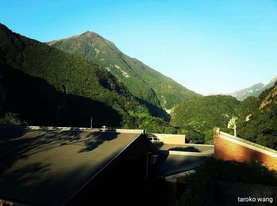
Taroko National Park is world class: Looking at the mountains from the Mesa Visitor Center in the early morning
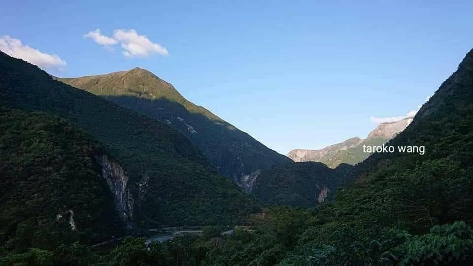
Taroko National Park is world-class: from the platform visitor center in the early morning, you can see the golden mountains and canyons.
At the mouth of Liwu River!
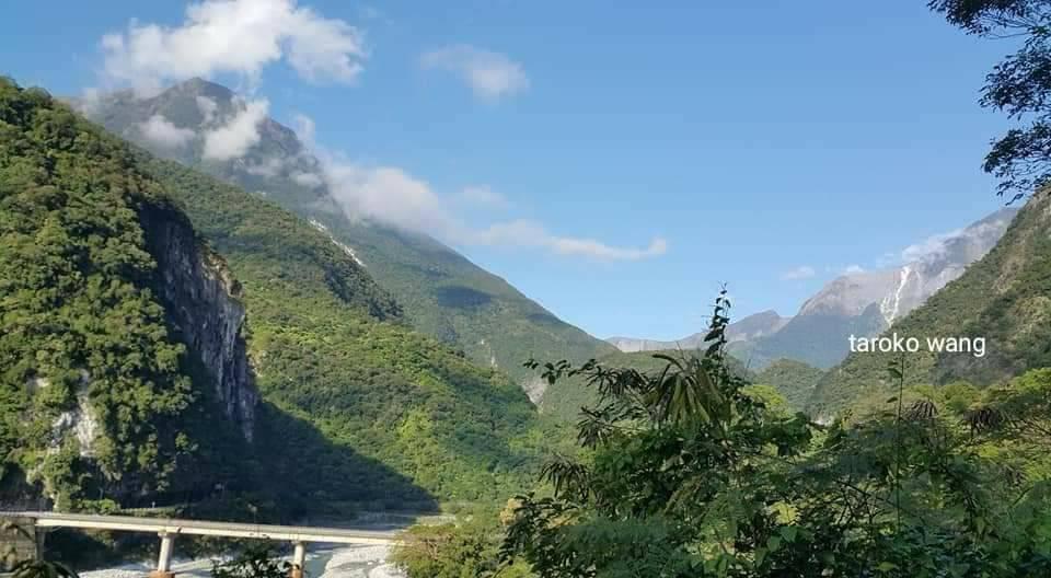
[Zhongheng and Taroko National Park]
[boundary]
Detailed links are as follows:
https://m.facebook.com/story.php?story_fbid=757993795595048&id=106670230727411
Boundary site is the boundary of land, and may have the meaning of declaring the scope.
Or look at it with emotion, we have entered the national park,
Or return to another home, a world of nature!
Try to share the boundary markers of Taroko Playhouse Park!
Taroko National Park covers an area of 92,000 hectares. It is a mountainous national park surrounded by mountains on three sides and close to the Pacific Ocean on one side. Liwu River runs through it, connecting the mountains and the sea!
Connected peaks and valleys, high mountains and deep valleys are the biggest features. More than 90% of the area is mountainous. The peaks in the northern section of the Central Mountains stretch across the area, such as Hehuan Peak, Black Qilai, Central Jianshan, the first of the three peaks, and Nanhu Mountain, one of the five mountains. , together constitute a unique and complete geographical landscape. Other special terrains include ring valleys, canyons, cliffs, high river steps, circulation hills, etc.
…from Taiwan National Park
Although it is a mountainous national park, it faces the Pacific Ocean, so the mountains and the sea are connected. Just like the northeast corner and the east coast, the mountains and the sea are connected. This is perhaps the biggest difference from Xueba and Yushan National Parks!
When we go from the north to the east or the center,
Whether you are going to Huadong, Zhongheng, Hehuan Mountain, Qingjing, or Wuling Lishan, you will always encounter the boundary monument of Taroko National Park! Every time I see it, I feel happy in my heart!
Try to share the boundary markers of Taroko National Park!
The boundary monuments of Taroko National Park are located on the old Suhua Highway, Provincial Highway 14A in Hehuanshan District, and Provincial Highway 8 on Zhongheng Highway in the direction of Dayu Ridge from Lishan.)
The first Heren boundary monument is located at 171.1km of the Suhua Highway on Provincial Highway 9, past the entrance to the National Park from Heren, right on the traffic thoroughfare. It is also the most commonly seen national park boundary marker passing through Suhua in the past. This is the gateway between the National Park and Suhua.
The northern boundary of the Suhua section of Taroko National Park is surrounded by mountains and sea!
The one with the highest frequency of occurrence on the Internet is probably the boundary address of Wuling in Hehuan Mountain.
But the Beijie and Renjie sites are also beautiful.
Once you pass through the Ho Yan Tunnel, look north towards the Ho Yan Beach and Ho Yan Station;
In the past, the traffic on Suhua Highway was so fast that it was difficult to get close to him!
Nowadays, it is different from the past. There is a separation of speed and slowness, and there are more opportunities to get closer.
The second one is the boundary monument in Hehuan Mountain area. Located on Provincial Highway 14A, next to the Kunyang parking lot, with the Qilai Peaks in the background! This is a must-stop when heading to Nantou Puli.
The third block is located on Provincial Highway 8 Zhongheng Highway, from Lishan to Dayu Ling in the direction of Zhiyuanzhuang. For details, please see the previous post.
The epic Taroko National Park! Whether it is the Qing Dynasty; the Japanese colonial period; the early Republic of China to the present;
A national park that aims to preserve the world’s landscape forever!
If travelers want to get close to Taroko National Park and explore Taroko National Park in depth, just start with the trails!
Shuyun: “The longer I walk, the less able I am to separate my body, mind and surrounding environment. The external and internal worlds overlap with each other. I am no longer an observer looking at nature, but my whole person is involved in it.” .
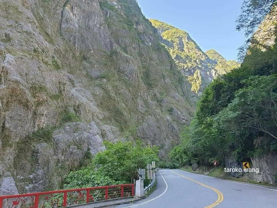
Connected peaks and ravines, high mountains and deep valleys are the most distinctive features of Taiwan’s Taroko National Park.
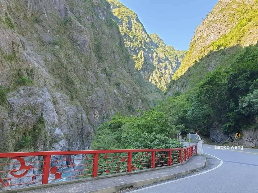
Connected peaks and ravines, high mountains and deep valleys are the most distinctive features of Taiwan’s Taroko National Park.
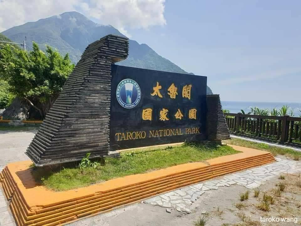
The northern boundary of the Suhua section of Taroko National Park is surrounded by mountains and sea!
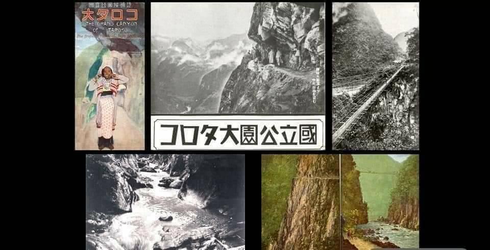
Schematic map of Taroko National Park during the Japanese occupation
[Taiwan Taroko National Park Shakadang Trail Small Cone Deer Trail]
[Taiwan Taroko National Park Changchun Temple Trail]
[Yanzikou Trail in Taroko National Park, Taiwan]
[Jiuqudong Trail in Taroko National Park, Taiwan]
[Taiwan Taroko National Park Green Water Confluence Trail]
[Taiwan Taroko National Park Tianxiang]
[White Poplar Trail in Taroko National Park, Taiwan]
[Taiwan Taroko National Park Shakadang Trail Small Cone Deer Trail]
The Shakadang Trail follows the Shakadang River, and you can see the clear Shakadang River, canyons, folded rocks and green woods.
The most special thing about the trail is that it seems to be embedded in the mountain wall. From a distance, it looks like a recessed corridor. When walking inside, the rock wall is right next to it, and you can feel the rocks of Taroko with your hands.
Also, because the rocks above are low and narrow, be careful not to hit your head when walking.
The Xiaozuilu Trail is located on the other side of the Shakadang Trail. If you have the physical strength, it is recommended that you walk together. The Xiaozuilu Trail weaves through the woods, with the Liwu River Valley on one side and the forest growing on the hillside on the other. From the trail, you can also overlook the wide riverbed downstream of the Liwu River.
On the Xiaozuilu Trail, you can admire the Xiaozuilu Cliffs and walk on the small suspension bridge.
Traffic information
Google map:
972 Shakadang Trail, Xiulin Township, Hualien County
972 Xiulin Township, Hualien County
Xiaozuilu Trail
Xiulin Township, Hualien County 972
03 862 1100#321

The beginning of the Shakadang Trail in Taroko National Park, Taiwan
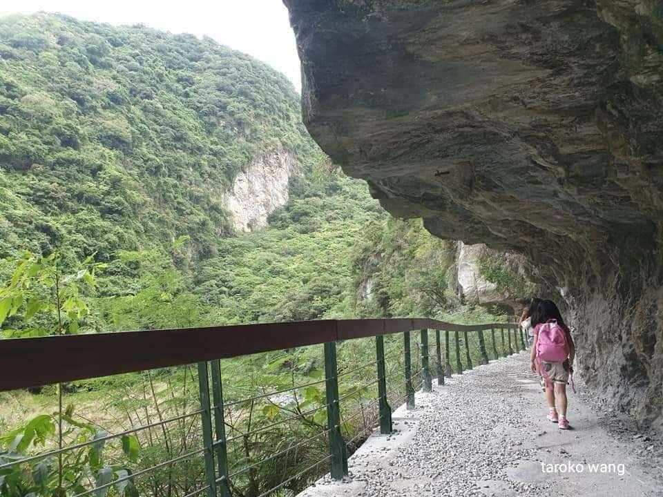
The Shakadang Trail in Taiwan’s Taroko National Park is set in the beautiful mountain wall like this.
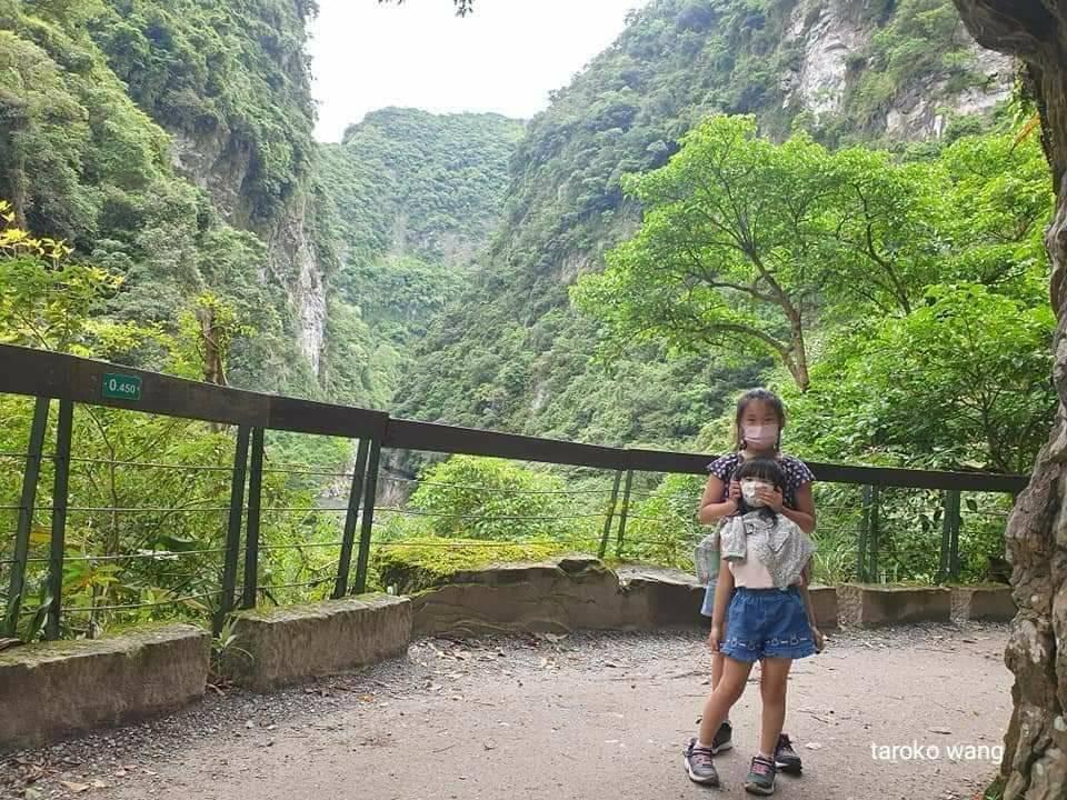
The Shakadang Trail in Taiwan’s Taroko National Park follows the Shakadang River and sees the clear Shakadang River, canyons, folded rocks and green woods.
[Taiwan Taroko National Park Changchun Temple Trail]
The Changchun Temple Trail is 2.1 kilometers long. If time permits, you can collect all the scenic spots along the Changchun Temple Trail at once, including the Changchun Temple, Guanyin Cave, Bell Tower, Changuang Temple, etc.
The view of the canyon from Zenkoji Temple is also unique! If you have time, it is recommended to visit.
It’s also like the view from Tianxiang Xiangde Temple!
you can walk from the Changchun Bridge to the Changchun Temple. It is a smooth and easy walk through the caves, and every step you pass through a cave has a view, giving you a unique feeling of a cave!
When walking to Chang Chun Temple, you can see:
Many road construction workers died during the construction of the Zhongheng Highway. The Tang-style architectural style Changchun Temple enshrines the memorial tablets of 225 sacrificed workers.
Looking out over the canyon from here, you can see the springs, and you can also see the Ning’an Bridge not far away. The scenery is beautiful!
The spring next to the Changchun Temple forms a waterfall and has become a landmark of special significance on the Zhongheng Highway.
There is a staircase on the cliff behind the Changchun Temple leading to the “Eternal Spring Temple Trail”. Along the way, you pass Guanyin Cave, Tailu Pavilion, Bell Tower, Changuang Temple, etc. It is quite bumpy. It is recommended that you consider your own conditions when walking. It is not open at the moment.
Traffic information
Google map:
Evergreen Temple Trail
972 Xiulin Township, Hualien County
03 862 1100#321
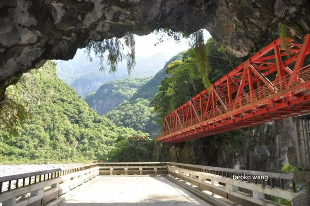
The beautiful observation deck reached from the Changchun Bridge on the Changchun Temple Trail in Taroko National Park, Taiwan.
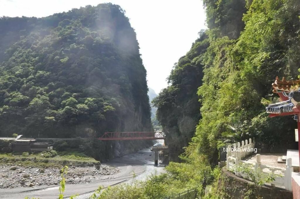
Changchun Temple Trail in Taroko National Park, Taiwan, looking back at the beautiful Changchun Bridge from the Changchun Temple
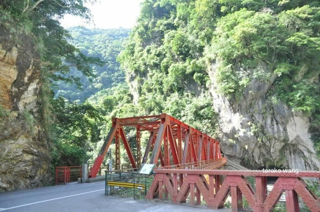
The beautiful Changchun Bridge on the Changchun Temple Trail in Taroko National Park, Taiwan
[Yanzikou Trail in Taroko National Park, Taiwan]
Since then, the Liwuxi Canyon has become narrower, and you can enjoy the Taroko Canyon, Hu Cave, Yongquan, Indian Chief Rock and other landscapes on the way.
The so-called trail is walking on the old road, so it is very easy to walk for travelers.
Because there are many small caves in the marble cliffs here that have been eroded by rivers and groundwater for a long time, swallows often build their nests here, forming the wonder of the “Hundred Swallows Valley”, so it is called “Swallow’s Mouth”.
The entrance to the Yanzikou Trail is the tunnel. Walk along the road. After entering, you can see the unique scenery outside the cave. Taking photos with the backlight has a different aesthetic feeling. It is easy to take beautiful photos online.
After exiting the trail and continuing forward, you can reach Jinheng Park, which was established to commemorate Section Chief Jin Heng who unfortunately died in the construction project of the Zhongheng Highway. There are restrooms here, and there are still old roads and trails to follow along.
From the observation deck, you can also see the wonders in the Liwu Creek Canyon – the Indian El Capitan. From a distance, it looks like the profile of a portrait, and even the eyes, nose, chin, and cheek depressions can be clearly seen. It’s so clear, and the green plants on the rocks look like Indians with feather crests, once again people can’t help but admire the magic of nature!
Traffic information
Google map:
Yanzikou Trail
972 Xiulin Township, Hualien County
03 861 2528

Classic photoshoot on the Yanzikou Trail in Taroko National Park, Taiwan

Yanzikou Trail in Taroko National Park, Taiwan

Not far from the classic photoshoot of the Yanzikou Trail in Taiwan’s Taroko National Park is the Jinheng Bridge
[Jiuqudong Trail in Taroko National Park, Taiwan]
To get here, it is almost impossible to park your own minivan, so it is recommended to take the Taiwan Express to get there.
Jiuqudong can be said to be one of the most essential sections of Taroko. Because the Jiuqudong trail is as winding as a nine-bend ileum, it is named “Jiuqudong”. General Huang Jie can also be seen on the rock wall. The inscription is “Like the return of intestines, like the meandering of a river, man is determined to conquer heaven, and this is the beginning of the game.”
Jiuqu Cave was opened after 6 years of renovation, and it feels very good to walk.
The Jiuqudong Trail is located in the towering marble canyon wall. You can see the rushing Liwu River downwards and the rock faults. The mountain walls on both sides are very close to each other. The steep terrain is amazing.
Soon after entering the entrance, you will come to a trail with transparent glass. Stepping on the glass, you can directly see the Liwu River Canyon and the trees on the mountain wall. It makes people feel very close to the canyon without any distance.
If you continue walking, you will gradually enter the winding part of the rock wall of Jiuqu Cave. After the new renovation, it has been illuminated with lights, making the rock wall landscape more layered and unforgettable.
Traffic information
Google map:
972 Jiuqudong Tunnel, Xiulin Township, Hualien County
972 Xiulin Township, Hualien County

Jiuqudong Trail in Taroko National Park, Taiwan. The Jiuqudong Trail is built in the towering marble canyon walls and has been under construction for six years.

Jiuqu Cave Trail in Taroko National Park, Taiwan: “Like the return of an intestine, like the meandering of a river, man is determined to conquer nature, and this is how it begins.”
[Taiwan Taroko National Park Green Water Confluence Trail]
The Green Water Confluence Trail is part of the Taroko Hehuan Crossing Trail. Since this section of the ancient trail is in good condition, walking along it is like walking through a historical corridor!
The path is about 2 meters wide, roughly maintaining the width of the Hehuan Crossing Trail during the Japanese colonial period. The entire path is gentle and easy to navigate. It is a landscape trail suitable for all ages.
There is also the Green Water Geology and Terrain Exhibition Hall at the entrance of the trail, which is currently a mountaineering school. There is the Green Water Cafe in front of the exhibition hall. There was a cafe open before the epidemic, but it is currently closed.
When operations resume in the future, it will be a great treat to enjoy the trail with coffee.
The entrance to the trail is located next to the Green Water Exhibition Hall. The trail does not take long, but the outlook is high and you can overlook the canyon from a high position. It is a trail with high CP value!
The rich landscape ecology is only about 2 kilometers in length. It is not too difficult and is very suitable for tourists of all ages.
However, foreign backpackers love nature and challenges, so many foreign backpackers tend to go to the Wenshan Green Water Trail, which has a longer mileage and longer time.
Because of its high difficulty, if you are not fully prepared, you can go there without warning!
The Green Water Confluence Trail is characterized by dense forests, cliff topography, rock plants, and cultural relics.
You can experience the cultural characteristics of Taroko National Park, and you can also observe the special plant ecology on the trail. Standing on the cliff, you can overlook the Liwu Valley and the Green Water River Steps!
Various rock plants can also be seen, showing their perseverance and vitality on the rock walls. They are very easy to observe on the Green Water Confluence Trail and the Shakadang Trail! Among them, Taroko oak is a precious and rare plant in Taiwan.
Highly recommend everyone to go!
Currently, only part of the Green Water Convergence Trail is open. For more detailed information, please refer to the national park website.
The link is as follows:
Traffic information
Google map:
green water trail
972 Xiulin Township, Hualien County
03 869 1466
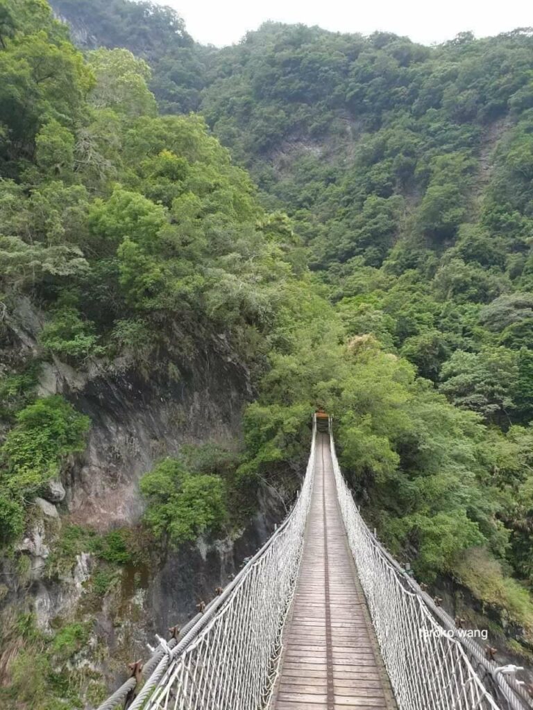
The beautiful Yuewangting Suspension Bridge near the Green Water Confluence Trail in Taroko National Park, Taiwan
【Taroko National Park Tianxiang】
Tianxiang can be said to be the largest recreation center in the eastern section of Taroko National Park and the largest accommodation center in the national park, about 19 kilometers away from Taroko.
It is the junction of high and low altitudes in Zhongheng, the watershed between the canyon terrain and the high mountain altitudes! The hinterland of this area is vast, with restaurants, hotels, bus stops, parking lots, post offices, etc. all available.
The old name is “Tabido”, which was the former residence of the Taroko tribe’s Tabido community. “Tapido” means mountain palm, so it was named because there used to be a large area of mountain palm here. When the Zhongheng Highway was opened, the government renamed “Tapido” to “Tianxiang” in memory of Wen Tianxiang.
Whenever I come to Tianxiang, I always go to Xiangde Temple and Wen Tianxiang Park for a walk, and I feel full of energy!
Standing on the Zhihui Bridge and looking around, you can see the mountains and the water, the topography of the meandering potholes, the outcrops of the gravel layer, and the rushing Liwu River. After crossing the Pudu Bridge and walking along the Xiangde Temple trail, there are the 26-foot-tall white-clad Guanyin statue, the seven-story Tianfeng Pagoda, the solemn Ksitigarbha Bodhisattva statue, and the magnificent Mahavira.
Dasha Creek and Tatsigili Creek converge here to form Wu Creek. After years of accumulation and erosion by the river water, a multi-layered river terrace terrain has been created. It is a large-scale creek terrace recreation area in the canyon of Taroko National Park.
The Taroko National Park Management Office has set up a service station here to provide tourist interpretation and consultation services.
The Jingying Hotel on the west side is the only tourist hotel in the national park and has become a tourist base. There is Tianxiang Christian Church in the back garden, and there is also a Catholic Church at the other end near the Youth Activity Center.
Tianxiang Management Station is responsible for various recreational facilities along the Zhongheng Highway from Cimu Bridge to Xinbaiyang, as well as interpretation and consulting services. There is a Tianxiang Visitor Center in the recreation area. If you go to Green Water Confluence,
Green Water Mountain and Baiyang Trail, it is recommended to come to Tianxiang Visitor Center for a walk!
Traffic information
Google map:
Tianxiang Management Station
No. 972 Xiulin Township, Hualien County
03 869 1466
Xiangde Temple
No. 10, Tianxiang, Xiulin Township, Hualien County 972
03 869 1120

Tianxiang Exhibition Hall in Taroko National Park, Taiwan is a good place to get to know Tianxiang

Tianxiang, Taroko National Park, Taiwan Winter is the most beautiful season

The plum blossoms are in full bloom in Tianxiang, Taroko National Park, Taiwan. Winter is the most beautiful season.

Tianxiang, Taroko National Park, Taiwan Winter is the most beautiful season
[White Poplar Trail in Taroko National Park, Taiwan]
[White Poplar Trail and Shuilian Cave in Taroko National Park, Taiwan]
You can refer to the following link:
Centennial Liwu River
In stormy times, the road to power generation and gold production
Baiyang Trail in Taroko National Park,
It has not been here for many years;
Previously, Shuilian Cave had been closed for several years and had not been reopened.
I remember that Shuilian Cave was opened two years ago.
I have always wanted to kiss you,
The photos of Shuiliandong are far less shocking than experiencing it in person.
It’s like a heavy rain in the cave. Instead of big and small beads falling on a jade plate, it pours like a downpour!
It is highly recommended that everyone go there to get rid of the summer heat.
The Poplar Trail is closely related to the history of the expansion of the Transverse Highway.
One of the construction roads built by Taipower in 1973 to develop the “Liwu River Hydropower Project”.
At that time, Taipower completed six construction roads one after another, which attracted the attention of academia, the media, and the Building and Construction Department. They were worried that once the project was completed, all the water in the middle reaches of the Liwu River would be used to generate electricity, and the downstream riverbed would dry up. The Taroko Canyon will have no water and will be difficult to continue to develop, and the canyon landscape will be greatly affected. The Economic Development Council gathered opinions from all parties and decided to shelve it. In the next two years, Taroko National Park was established!
Although there seems to be no clear connection between the Baiyang Trail and the Japanese occupation period, when Taipower initially developed the “Liwu Creek Hydropower Project”, it was to continue Japan’s Liwu Creek power generation and reservoir construction project;
At that time, the century-old Liwu River was a prosperous and gold-producing road during the Japanese colonial period, so the Baiyang Trail still has a deep connection with the Japanese colonial period.
I remember that before the epidemic, Japanese people were often seen in Zhongheng’s Green Water Exhibition Hall and underneath the Green Water Management Station. I was puzzled at the time, but it was only recently that I suddenly understood. It’s just like the history of Jinguashi during the Japanese occupation!
During the Japanese colonial period, after the outbreak of the Pacific War, great emphasis was placed on the policy of “gold production” and “power generation”.
The Japanese thought a lot about the national policy at that time!
During the Japanese colonial period, the foundation of Hualien Port’s industry was to use the hydroelectric power generated by Liwu Creek. During the Japanese colonial period, due to the outbreak of the Pacific War, the Japanese government’s economy was in dire straits, and the Eastern Taiwan government was in the national wave of whole-of-government mobilization. The Japanese government planned Under the strategic policy of building Taiwan into a “Southern Expansion Base”, “Industrial Hualien, Agricultural Taitung” has become the role Huadong will play in the future.
Viewing Hualien Port, please see the previous post for details:
In the 14th year of the Showa Period, Hualien Port was opened to water and became the third largest port after Keelung and Kaohsiung.
Hualien Port will become an import port and manufacturing production center for resources from Japan’s southern occupied territories to Taiwan. Among them, military aluminum and other metals are industrial representatives, and Hualien Port must be built into an industrial park.
In particular, the aluminum and other metal industries are crucial to national defense needs and require huge amounts of electricity!
At that time, Hualien Port had unique conditions in terms of good port, raw materials, electricity, and land acquisition. The development and utilization of Liwu River hydropower was an important key to the success or failure of the Hualien Port Industrial Zone.
Therefore, the “East Taiwan Electric Power Industry Co., Ltd.” was established to integrate and develop river power near Hualien Port, including the Papaya River Tongmen Power Station and the “Tachiqili No. 1 Power Station” in Dede Kalunshe on the north bank of the Liwu River upstream. , using the creek bank as a water intake for hydroelectric power generation. The route along the Liwu River in Zhongheng could be said to be a road for “power generation” and “gold production” during the Japanese colonial period!
[White Poplar Trail and Shuilian Cave in Taroko National Park, Taiwan]
You can find the link below for Baiyang Trail
Baiyang Trail in Taroko National Park,
It has not been here for many years;
Previously, Shuilian Cave had been closed for several years and had not been reopened.
I remember that Shuilian Cave was opened two years ago.
I have always wanted to kiss you,
The photos of Shuiliandong are far less shocking than experiencing it in person.
It’s like a heavy rain in the cave. Instead of big and small beads falling on a jade plate, it pours like a downpour!
It is highly recommended that everyone go there to get rid of the summer heat.
The name of the Baiyang Trail comes from the fact that it is located under the ancient poplars of the old Taroko tribe, so it is called the Baiyang Trail.
The waterfall at the end was therefore changed to Baiyang Falls. Previously, the Japanese called it “Kageon Falls” because they thought her beauty was comparable to Kegon Falls, the second of Japan’s three most famous waterfalls. As for the Taroko people, they call this fault-type waterfall “Daolas”.
The Baiyang Trail has rich landscapes and is easy to walk, including waterfalls, suspension bridges, tunnels, canyons and other landscapes. Taipower excavated and built it to continue Japan’s Liwu River power generation and reservoir construction project. The project was suspended at that time, so it became a hiking trail. However, this trail is like a golden trail among many easy-to-reach trails.
The trail was originally 9.5km long, but currently it is only 2.1km walkable. In the early days, the trail could reach Xiaojiuqu, but it is currently closed.
You can take public transportation and walk 400 meters from Tianxiang to Luoshao. The tunnel has a well-designed separation of pedestrians and vehicles, and there are parking spaces on the left side of the road. This is really great, because currently there is no hinterland in Yanzikou and Jiuqudong. There is parking space.
Baiyang Trail has officially arrived. From the entrance to Shuilian Cave, there are seven tunnels in just 2.1 kilometers.
This is the first tunnel with a length of 380 meters, and is also the longest one. There is no lighting equipment at all in the tunnel, and the floor is wet. However, there is a light to guide the exit, so it is not too difficult to walk even without a flashlight.
The Waheer Creek along the way, with its uncanny beauty of river cuts, always makes people unable to take their eyes off it. The Baiyang Trail is right in the middle, and the entire road is so flat and easy to walk. It can be said that it is suitable for the whole family.
Moving forward, there is an exposed rock wall not far from the fourth tunnel. The geology is mainly black schist and green schist. The rock formations in this area are particularly unstable and it is one of the most dangerous sections of the Baiyang Trail. Just hurry up and pass.
The third and sixth tunnels are longer. After passing the cement bridge after the sixth tunnel, there is a giant vortex eroded by Tashijili River below. Turn left on the suspension bridge to reach the Baiyang Waterfall viewing platform and continue forward. After a short walk, you can reach Shuilian Cave.
Tatsikiri Creek is the upper reaches of Liwu Creek. During the Japanese colonial period, the entire Liwu Creek was formerly known as “Tashikiri Creek”.
“Taji” in Japanese means upright or standing, “Riki” means clouds, and “Taji” means the towering cliffs on both sides of the stream.
After the liberation of Taiwan, the Tazikili River was bounded by Tianxiang, and the downstream river was renamed “Liwu River”, while the upper reaches still maintained its old name. The Taroko people originally called Liwu Creek “Yayung Paru”, which means “very big stream”.
You can immediately see the secret attractions in Hualien, Baiyang Trail, Shuiliandong and Baiyang Waterfall.
Although the entire trail is flat, according to regulations, pets are not allowed here. Dogs, cats, etc. are not allowed, so don’t break the law.
Don’t throw away used raincoats. Take them away or give them to the next group of tourists going to Shuilian Cave.
In the past, Baiyang Waterfall was called “Daolas”, which means cliff. At that time, the confluence of Liwu Creek and Waheer Creek was where the “Daolas” tribe was located. Baiyang Falls is divided into three levels, with the top level being the most spectacular.
<Route>
Passing through: First to Sixth Tunnels, Observation Deck, Seventh Tunnel, First Shuilian Cave
2.1Km from tunnel entrance to No. 1 Shuilian Cave
<Notes>
- Carry a raincoat and do not throw it away after use
- Carry a flashlight
- Bring rain boots if you want to have a good time
- Therefore, please pay more attention to the environmental conditions when entering Shuiliandong;
There is only a trail along the mountain wall in the tunnel. The path is slippery and the rocks on the mountain wall are uneven, so be careful of collisions or falls.
- You can see many bats in the cave. We used the long exposure of the camera to take clear pictures. Please do not turn on the flash to take pictures of bats and disturb their sleep!
- You can borrow safety helmets from Tianxiang Visitor Center
<Transportation>
- Take Taiwan Travel to Tianxiang Station and walk 400M
- Park your car at the Baiyang Trail parking lot
Poplar Trail Parking Lot
Traffic information
Google map:
Poplar Trail
972 Hualien County Xiulin Township Channel 8 Line 166.5K
03 869 1162
Baiyang Trail Water Curtain Cave
Within 166.5K Baiyang Trail, Route 8, Xiulin Township, Hualien County, 972
03 869 1162
If travelers want to get close to Taroko National Park and explore Taroko National Park in depth, just start with the trails!
Get close to the national park trails,
Just start by taking Taiwan’s bus, Taiwan Travel!
Flight schedules and times can be checked on the following website!
Very convenient!
Tickets can be purchased at:
1.Taiwan Unified Passenger Transport Ticket Office
2.7-11 ibon
3.FamiPort
4.KLOOK
5.KKday
If you go by train, you can go to the transfer station at Hualien Railway Station
Traffic information
Google map:
Hualien Transfer Station
No. 98, Guolian 1st Road, Hualien City, Hualien County 970
03 890 0388
Or change to a bus at Xincheng Railway Station and take a bus from Taiwan (Taiwan Hao Xing)
Traffic information
Google map:
Xincheng Railway Station
No. 73, Xinxing 1st Road, Xincheng Township, Hualien County 971
03 835 5941
台灣太魯閣國家公園白楊步道瀑布及水濂洞是一絕
The Baiyang Trail in Taiwan’s Taroko National Park is about to enter Shuilian Cave

Shuilian Cave, Baiyang Trail, Taroko National Park, Taiwan
Get close to the national park trails,
Just start by taking Taiwan’s bus, Taiwan Travel!
The most convenient thing for travelers is to take the train to Hualien or Xincheng Station and transfer to the bus. Taiwan is very convenient!
The epic Taroko National Park!
Whether it is the Qing Dynasty, the Japanese colonial period, or the early Republic of China to the present, the national park aims to preserve the world’s landscape forever!

